DIGITAL LAND SURVEY? digital survey land
డిజిటల్ ల్యాండ్ సర్వే (Digital Land Survey) అంటే ఏమిటి?
DIGITAL ల్యాండ్ సర్వే అంటే ఏమిటి?
డిజిటల్ ల్యాండ్ సర్వే అనేది ఆధునిక సాంకేతిక పరిజ్ఞానాన్ని ఉపయోగించి భూమి సరిహద్దులు, విస్తీర్ణం మరియు స్థానం వివరాలను ఖచ్చితంగా కొలిచే ప్రక్రియ.
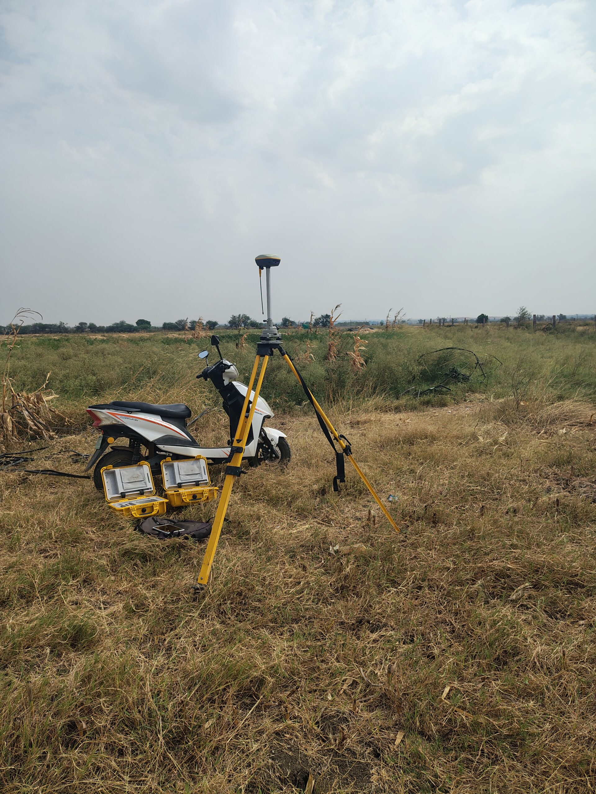
సంప్రదాయ కొలత పద్ధతుల స్థానంలో GPS, DGPS, Total Station, డ్రోన్లు మరియు GIS వంటి ఆధునిక పరికరాలను ఉపయోగించి భూమి వివరాలను డిజిటల్ రూపంలో నమోదు చేస్తారు.
ఈ విధానం ద్వారా భూమి యజమానులకు ఖచ్చితమైన రికార్డులు అందుబాటులోకి వస్తాయి మరియు భూ వివాదాలు తగ్గుతాయి.
డిజిటల్ ల్యాండ్ సర్వే ఎందుకు అవసరం?DIGITAL LAND SURVEY? digital survey land
* భూమి సరిహద్దులను ఖచ్చితంగా గుర్తించడానికి
* ఆక్రమణలను నివారించడానికి
* భూ రికార్డులను నవీకరించడానికి
* ఆన్లైన్ భూ సేవలను మెరుగుపరచడానికి
* భూమి కొనుగోలు మరియు విక్రయ ప్రక్రియను సులభతరం చేయడానికి
డిజిటల్ ల్యాండ్ సర్వేలో ఉపయోగించే పరికరాలు
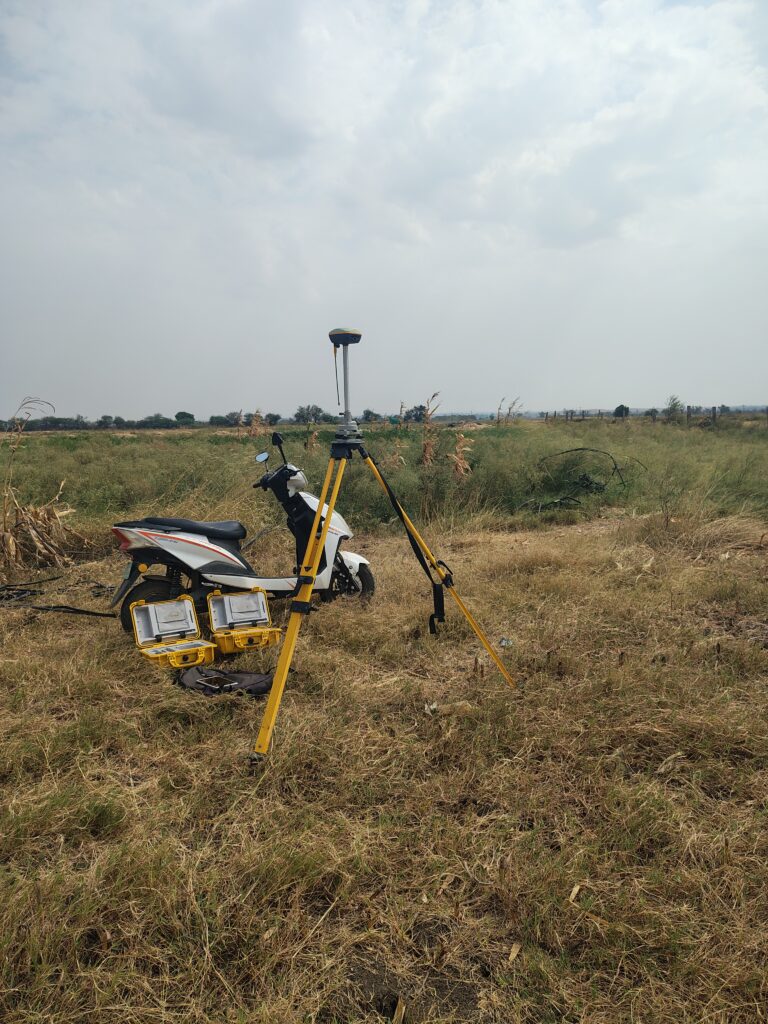
1. GPS (Global Positioning System)
ఉపగ్రహాల సహాయంతో భూమి ఖచ్చితమైన స్థానాన్ని గుర్తిస్తుంది.
2. DGPS (Differential GPS)
సాధారణ GPS కంటే ఎక్కువ ఖచ్చితత్వంతో కొలతలను అందిస్తుంది.
3. Total Station
దూరం, కోణాలు మరియు ఎత్తులను ఖచ్చితంగా కొలిచే ఆధునిక సర్వే పరికరం.
4. డ్రోన్లు (Drones)
గాలిలో నుండి భూమి చిత్రాలను సేకరించి మ్యాపింగ్ కోసం ఉపయోగిస్తారు.
5. GIS (Geographic Information System)
భూమి డేటాను డిజిటల్ మ్యాప్ రూపంలో నిర్వహించే సాంకేతిక వ్యవస్థ.
డిజిటల్ ల్యాండ్ సర్వే ప్రయోజనాలు
అధిక ఖచ్చితత్వం
సాంప్రదాయ సర్వేతో పోలిస్తే మరింత ఖచ్చితమైన ఫలితాలు అందిస్తాయి.
సమయం ఆదా
కొద్ది సమయంలో పెద్ద ప్రాంతాలను సర్వే చేయవచ్చు.
డిజిటల్ రికార్డులు
భూమి వివరాలు డిజిటల్ రూపంలో భద్రపరచబడతాయి.
భూ వివాదాల తగ్గింపు
సరిహద్దులు స్పష్టంగా ఉండటం వల్ల వివాదాలు తగ్గుతాయి.
పారదర్శకత
ప్రభుత్వ భూ రికార్డుల నిర్వహణ మరింత పారదర్శకంగా మారుతుంది.
డిజిటల్ ల్యాండ్ సర్వే ప్రక్రియ DIGITAL LAND SURVEY? digital survey land
1. భూమి యజమాని దరఖాస్తు సమర్పించడం
2. సర్వే తేదీ నిర్ణయించడం
3. సర్వే బృందం భూమిని పరిశీలించడం
4. GPS లేదా Total Station ద్వారా కొలతలు తీసుకోవడం
5. డిజిటల్ మ్యాప్ తయారు చేయడం
6. రికార్డులను ఆన్లైన్లో నమోదు చేయడం
7. తుది సర్వే నివేదిక అందించడం
తెలంగాణ మరియు ఆంధ్రప్రదేశ్లో డిజిటల్ ల్యాండ్ సర్వే DIGITAL LAND SURVEY? digital survey land
తెలంగాణ మరియు ఆంధ్రప్రదేశ్ ప్రభుత్వాలు భూ రికార్డులను ఆధునీకరించేందుకు డిజిటల్ సర్వే కార్యక్రమాలను అమలు చేస్తున్నాయి. ఈ కార్యక్రమాల ద్వారా సర్వే నంబర్లు, భూమి విస్తీర్ణం మరియు యాజమాన్య వివరాలను డిజిటల్ రూపంలో నమోదు చేస్తున్నారు.
డిజిటల్ ల్యాండ్ సర్వే వల్ల రైతులకు కలిగే ప్రయోజనాలు
* భూమి హక్కుల రక్షణ
* ఖచ్చితమైన సర్వే మ్యాపులు
* రుణాల కోసం సులభమైన పత్రాలు
* భూ వివాదాల పరిష్కారం
* ప్రభుత్వ పథకాల ప్రయోజనాల పొందడం
ముగింపు
డిజిటల్ ల్యాండ్ సర్వే భూ రికార్డుల నిర్వహణలో ఒక కీలకమైన ఆధునిక విధానం. GPS, Total Station మరియు GIS వంటి సాంకేతిక పరికరాల సహాయంతో భూమి సరిహద్దులను ఖచ్చితంగా గుర్తించి డిజిటల్ రికార్డులను రూపొందించడం ద్వారా భూ యజమానులకు, రైతులకు మరియు ప్రభుత్వానికి ఎంతో ఉపయోగకరంగా మారింది. భవిష్యత్తులో భూ రికార్డుల నిర్వహణ పూర్తిగా డిజిటల్ విధానంలోకి మారే అవకాశం ఉంది.
ENGLISH VERSION ;-
Digital Land Survey: Complete Guide, Benefits, Process, and Importance
Digital Land Survey: A Complete Guide, Benefits, Process & Importance
What is a land survey in the digital era?LAND SURVEY DIGITAL? |land digital survey
A Digital Land Survey is a modern way of measuring
and mapping land using advanced technologies such as GPS, DGPS, Total Station, Drones, and GIS.
Digital surveys offer precise measurements and produce digital records of land boundaries, area, and location, unlike traditional land surveying methods.
Digital land surveys help governments, landowners, farmers, and real estate professionals maintain accurate land records and reduce land-related disputes.
Why is Digital Land Survey Important?
Digital land surveys are essential for:
* Identifying accurate land boundaries
* Preventing land encroachments
* Updating land records
* Improving online land management services
* Simplifying property transactions
* Reducing land disputes
* Ensuring transparency in land administration
Technologies Used in Digital Land Survey
1. GPS (Global Positioning System)
GPS uses satellite signals to determine the exact geographic location of a piece of land.
2. DGPS (Differential Global Positioning System)
DGPS provides higher accuracy than standard GPS and is commonly used for precise land measurements.
3. Total Station
A Total Station is an advanced surveying instrument used to measure distances, angles, and elevations with high precision.
4. Drones
Drones capture aerial images and data, making it easier to survey large areas and create detailed land maps.
5. GIS (Geographic Information System)
GIS is a digital mapping system used to collect, manage, analyze, and display land-related data.
Benefits of Digital Land Survey
High Accuracy
Digital surveys provide more accurate results compared to traditional surveying methods.
Time Saving
Large areas can be surveyed quickly and efficiently.
Digital Records
Land information is stored electronically for easy access and future reference.
Reduced Land Disputes
Clearly defined boundaries help minimize conflicts between landowners.
Better Land Management
Governments can manage land records more effectively and transparently.
Improved Property Transactions
Accurate land information simplifies buying, selling, and registration processes.
Digital Land Survey Process
The digital land survey process typically includes the following steps:
1. Submission of a survey request or application IN MEE SEVA BHUBHARATHI
2. Scheduling of the survey
3. Site inspection by survey officials
4. Measurement using GPS, DGPS, or Total Station equipment
5. Collection of land data and coordinates
6. Preparation of digital maps and survey reports
7. Updating official land records
8. Issuance of final survey documents
Digital Land Survey in Telangana and Andhra Pradesh
The governments of Telangana and Andhra Pradesh are implementing digital land survey projects to modernize land records. These initiatives help create accurate digital maps, verify ownership details, and improve transparency in land administration.
Digital surveys also support online land services and facilitate quicker access to land-related information.
Benefits for Farmers and Landowners
Digital land surveys offer several advantages to farmers and landowners, including:
* Protection of land ownership rights
* Accurate measurement of agricultural land
* Easier access to bank loans and financial assistance
* Faster resolution of boundary disputes
* Better eligibility for government schemes
* Reliable land records for future transactions
Challenges in Digital Land Survey
Despite its advantages, digital land surveying may face challenges such as:
* High implementation costs
* Need for trained survey professionals
* Technical equipment maintenance
* Updating old land records
* Resolving historical ownership disputes
Conclusion
Digital Land Survey is a revolutionary step toward modern land management. By using advanced technologies such as GPS, DGPS, Total Station, Drones, and GIS, digital surveys provide accurate land measurements, secure land records, and reduce disputes.
As governments continue to digitize land records, digital land surveys will play a crucial role in creating transparent, efficient, and reliable land administration systems for the future.
THANS FOR VISIT FOR MORE UPDATES FOLLOW digital survey land