WHAT IS VILLAGE MAP? HOW TO CHECK BHUBHARATHI?
Village map అంటే ఏమిటి?
📌 Village Map అంటే ఏమిటి?
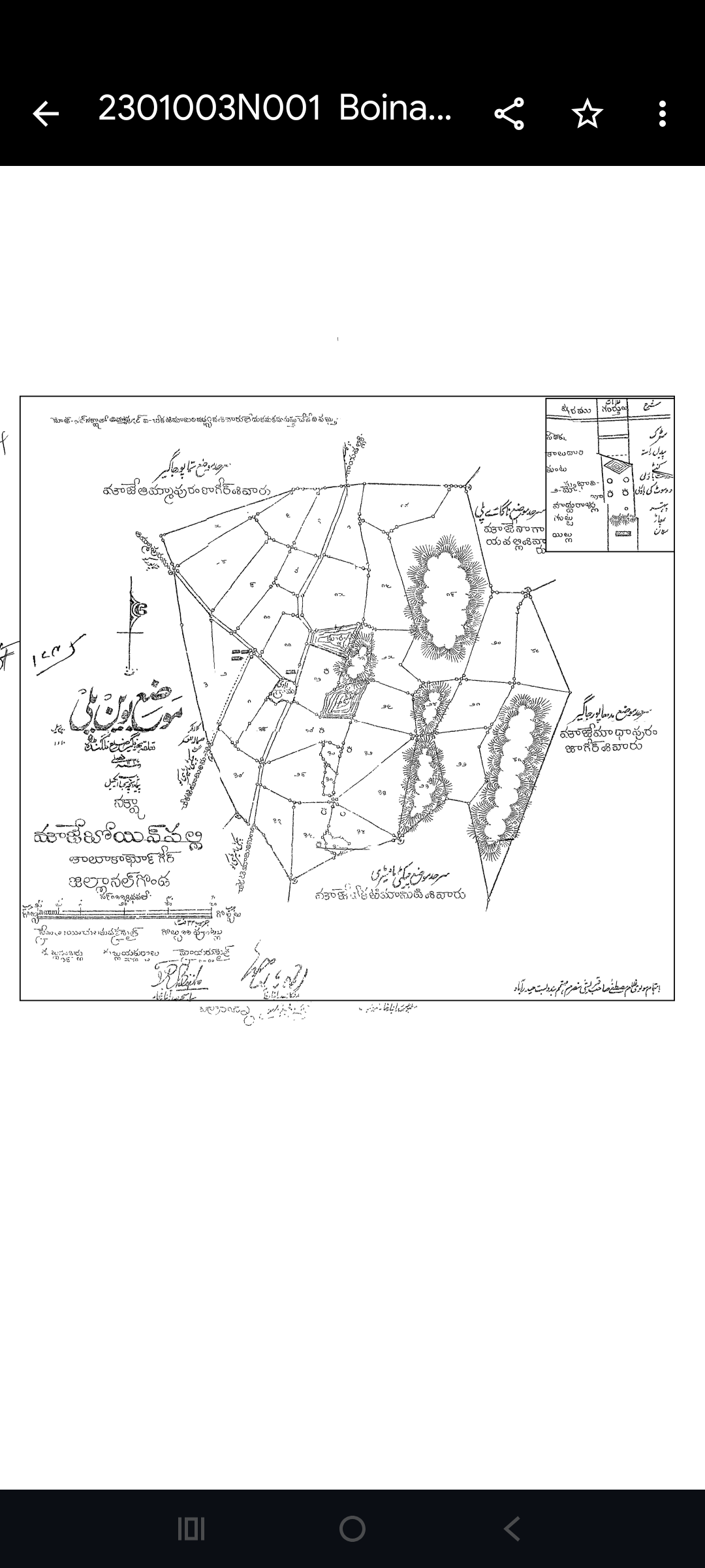
**Village Map అంటే ఒక గ్రామానికి సంబంధించిన భూమి వివరాలను చూపించే అధికారిక పటం (map).**
Village map MAIN POINTS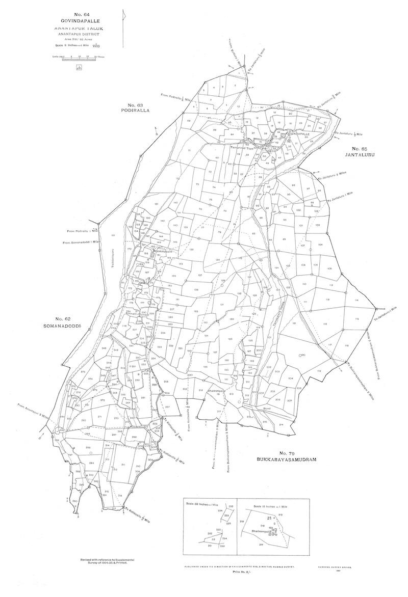
ఈ మ్యాప్లో:
* భూమి సరిహద్దులు
* రోడ్లు & మార్గాలు
* నీటి వనరులు
* ప్రభుత్వ భూములు
అన్నీ స్పష్టంగా చూపిస్తారు.
👉 ఈ మ్యాప్ను **Revenue Department** తయారు చేసి నిర్వహిస్తుంది.
📍 Village Map లో ఉండే ముఖ్యమైన వివరాలు:
1️⃣ Survey Numbers
ప్రతి భూమికి ప్రత్యేకమైన survey number ఇవ్వబడుతుంది.
2️⃣ Land Boundaries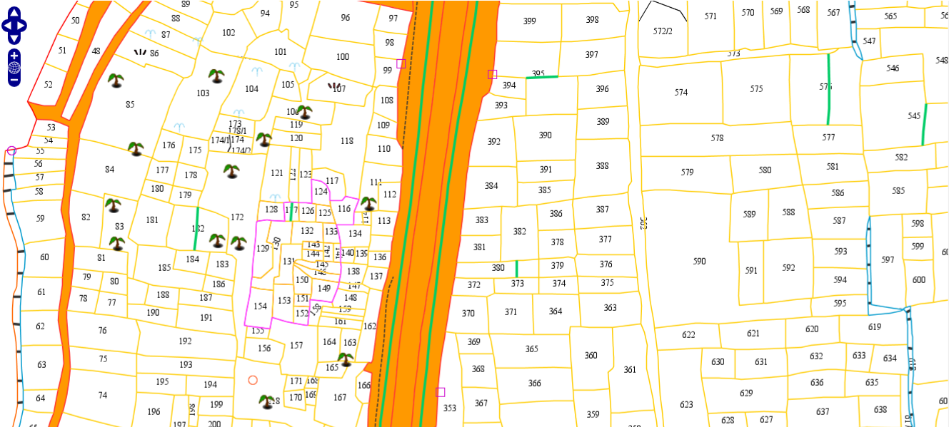
ప్రతి survey numberకి సంబంధించిన సరిహద్దులు చూపిస్తాయి.
3️⃣ Roads & Paths
గ్రామంలోని రోడ్లు, దారులు వివరంగా ఉంటాయి.
4️⃣ Water Bodies
చెరువులు, కాలువలు, వాగులు వంటి నీటి వనరులు కనిపిస్తాయి.
5️⃣ Government Lands
పొరంబోకు, ప్రభుత్వ భూములు స్పష్టంగా చూపిస్తాయి.
🎯 Village Map ఎందుకు ముఖ్యమైనది?
✔️ భూమి **exact location** తెలుసుకోవడానికి
✔️ **Survey number boundaries** అర్థం చేసుకోవడానికి
✔️ **Encroachment / Dispute** సమస్యలు నివారించడానికి
✔️ **Layout planning & Land verification** కోసం ఉపయోగపడుతుంది
📝 సింపుల్గా చెప్పాలంటే:
👉 Village Map = ఒక గ్రామంలోని భూముల పూర్తి వివరాలు + survey numbers చూపించే అధికారిక పటం
FOR ENGLISH READING ;-
What is a Village Map?
Introduction
A Village Map is an official land map that displays detailed information about land parcels within a village. It is prepared and maintained by the Revenue Department and serves as an important reference for landowners, buyers, surveyors, and government authorities.
Key Features of a Village Map WHAT IS VILLAGE MAP? HOW TO CHECK BHUBHARATHI?
A Village Map includes:
1. Survey Numbers
Each land parcel is assigned a unique survey number for identification and record.
2. Land Boundaries
The map clearly shows the boundaries of each survey number, helping to identify the exact extent of a property.
3. Roads and Pathways
Village roads, access routes, and pathways are marked to provide a clear understanding of connectivity within the village MAPFOR MORE INFORMATION PLEASE FOLLOE .
4. Water Bodies
Natural and man-made water resources such as ponds, tanks, canals, streams, and rivers are displayed on the map.
5. Government Lands
Government-owned lands, poramboke lands, and other public properties are clearly identified.
Why is a Village Map Important?
A Village Map is useful for:CHECKED OUT HERE;-
- Identifying the exact location of a land parcel.
- Understanding survey number boundaries.
- Preventing land disputes and encroachments.
- Verifying land details before purchase or sale.
- Supporting land development and layout planning.
- Assisting in land surveys and legal documentation.
Conclusion
In simple terms, a Village Map is an official map that provides a complete visual representation of a village’s land records, survey numbers, boundaries, roads, water bodies, and government lands. It plays a crucial role in land verification, property management, and dispute resolution.
FOR MOE INFORMATION PLEASE FOLLE MY BLOG THANKS FOR VISITING BY BLOG .what is village map